Geography of Martinique
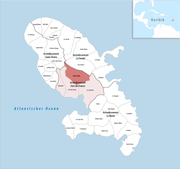
The French Overseas Department of Martinique is a Caribbean island belonging to the Lesser Antilles group in the Caribbean Sea, southeast of Cuba and north of Trinidad and Tobago. It is part of the French West Indies. It lies near the Tropic of Cancer between 14° 26' and 14°53' latitude north and 63° 9' and 63° 34' longitude west. At most some 50 miles long and 22 miles wide, Martinique covers an area of 425 square miles. Its coastline is so indented that no part of the island is more than seven miles from the sea.
Read article
Top Questions
AI generatedMore questions
Nearby Places

Martinique
Overseas department of France in the Caribbean

French West Indies
French territories in the Caribbean

Saint-Joseph, Martinique
Commune in Martinique, France

Gros-Morne, Martinique
Commune in Martinique, France

Invasion of Martinique (1762)
Military action that took place in January and February 1762. It was part of the Seven Years' War

Balata Garden
Rivière Blanche (Martinique)
River in Martinique

Battle of Martinique (1794)


